About ROAM GPS: Offline Maps for Hiking, Biking, & More!
INTRODUCING THE ROAM APP BY ONXMAPS ROAM turns your phone or tablet into a handheld GPS w/ extensive outdoor map data! Find new places to recreate using the most complete public lands & open spaces maps ever created....
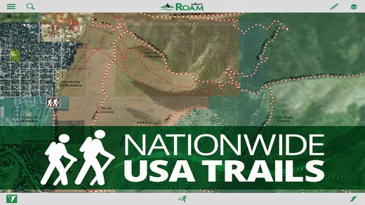
INTRODUCING THE ROAM APP BY ONXMAPS ROAM turns your phone or tablet into a handheld GPS w/ extensive outdoor map data! Find new places to recreate using the most complete public lands & open spaces maps ever created. Going out of cellular data coverage? No problem! Your GPS works even without cell service and you can save your maps and markups for offline use. Turn Your smartphone or tablet into a powerful handheld GPS Discover new trails by browsing the most comprehensive nationwide trails map ever created Find Open Space w/ onXmaps accurate Public Lands data We ve combined all your paper maps into a much more customizable digital map suite. Turn Map Layers and Basemaps on and off to customize your maps for your favorite activity See Recreation Access Areas and Water Sports Access Points Switch between comprehensive Base maps including Aerial imagery, 24K topo, and Hybrids Save Maps for Offline Use when out of cell coverage Create Geotagged Photo Waypoints and Customized Waypoints Auto-Sync and Share Waypoints, Tracks, Measurements, and Stats w/ your Team and between your devices FREE TRIAL While the App and many of it s features are free. You will start a free Roam Nationwide & State Private Parcels trial when you install the App. This allows you to try our full app for 7 days. Roam Nationwide membership is $9.99/year & state private parcel memberships are $19.99/year. ROAM APP FEATURES MAP DATA FEATURES Public Lands: Nationwide Federal & State (the most accurate & complete nationwide dataset ever created) City & County Open Space Trail & Trailhead locations, names & numbers Geographic & Recreational Point of Interests Water Data Weather & Radar Campgrounds & secluded Campsites Ski runs & lifts National Park Service Visitor maps National Forest Visitor Maps (save thousands on paper maps!) Motor Vehicle Roads & Trails (MVUM) displaying National Forest System (NFS) Routes (roads & trails) open to motorized travel Nationwide USFS Roads Nationwide USFS Trails & Wilderness USGS Gage Stations USGS Snotel (snowfall measurements) Wildfire Historic Perimeters Active Fires Private Landowner Names w/ Property Boundaries BASEMAPS USGS Topo (Quads) Aerial Imagery Imagery+Topo Hybrid OpenStreetMap USA Topo Maps Ocean BaseMap GPS Functionality on Your Phone or Tablet GPS Location Mark Waypoints Tracks Compass Mode View elevation profiles TRACKING FUNCTIONALITY Active track on/off MARKUPS & DRAW TOOLS Place Points on the map Geotag Photos Use Custom ROAM Waypoint Symbols Draw Lines Draw Shapes MULTIPLE DEVICES (my.onxmaps Cloud sync): ROAM anywhere! One account gives you access across multiple devices. Simply log in to your account & access all your map content that is automatically saved to your account SHARE VIA SOCIAL, TEXT, OR EMAIL Tracks Markups MEASURE TOOLS Distances Perimeters Areas SEARCH Search for nearby places Points of Interest Landowner Names AUTOMATIC MAP UPDATES The newest map data is automatically streamed into your device w/ no cumbersome update process USE SAVED MAPS MODE Forces the app to use your saved maps when in areas of low cell signal Saves on battery life MANAGE SUBSCRIPTION Subscriptions are yearly based and vary between $9.99 - $19.99 US depending on the subscription. Turn off auto-renewal via the main Settings app: https://support.apple.com/en-us/HT202039 Subscription automatically renews unless auto-renew is turned off at least 24-hours before the end of the current period. Your iTunes account will be charged for renewal within 24-hours prior to the end of the current period, & identify the cost of the renewal. Payment will be charged to iTunes Account at confirmation of Purchase. Visit the following URL for full terms of use: http://www.onxmaps.com/tou Note: As w/ all mapping apps, continued use of GPS running in the background can dramatically decrease battery life.
Requires iOS 8.0 or later. Compatible with iPhone, iPad, and iPod touch.
Previous Versions
Here you can find the changelog of ROAM GPS: Offline Maps for Hiking, Biking, & More! since it was posted on our website on 2016-10-07 07:01:24.
The latest version is 1.2 and it was updated on 2024-04-22 18:21:33. See below the changes in each version.
ROAM GPS: Offline Maps for Hiking, Biking, & More! version 1.2
Updated At: 2015-09-04
Disclaimer
Official App Store Link
We do not host ROAM GPS: Offline Maps for Hiking, Biking, & More! on our servers. We did not scan it for viruses, adware, spyware or other type of malware. This app is hosted by Apple and passed their terms and conditions to be listed there. We recommend caution when installing it.
The App Store link for ROAM GPS: Offline Maps for Hiking, Biking, & More! is provided to you by apps112.com without any warranties, representations or guarantees of any kind, so access it at your own risk.
If you have questions regarding this particular app contact the publisher directly. For questions about the functionalities of apps112.com contact us.